
Fail:Tannenberg3008.jpg
Selle eelvaate suurus: 775 × 600 pikslit. Teised eraldusvõimed: 310 × 240 pikslit | 620 × 480 pikslit | 993 × 768 pikslit | 1242 × 961 pikslit.
Algfail (1242 × 961 pikslit, faili suurus: 207 KB, MIME tüüp: image/jpeg)
| See fail ja sellest kastist allapoole jääv kirjeldus pärinevad kesksest failivaramust Wikimedia Commons. | Faili lehekülg Commonsis |

|
Vektorkujutis (SVG) sellest pildist on saadaval. Kui SVG-pilt paremat kvaliteeti võimaldab, tuleks seda rasterkujutise asemel kasutada.
File:Tannenberg3008.jpg → File:East Prussian Campaign (27—30 Aug 1914) - ru.svg
|
_-_ru.svg) |
| Kirjeldus |
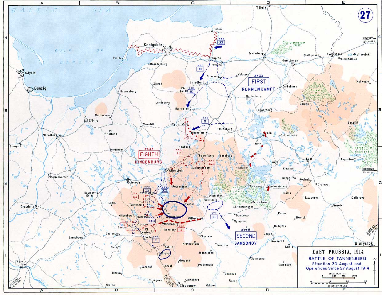
English: Battle of Tannenberg (1914) in its last phase |
| Allikas |
Taken from the campaign series, made public by the US-Army under dean.usma.edu
|
| Autor | US-Army under www.dean.usma.edu |
| Luba (Faili edasikasutus) |
The picture is public domain. |
See pilt on Ameerika Ühendriikide maaväe sõduri või teenistuja tehtud või üles võetud ametikohustuste täitmise ajal. Ameerika Ühendriikide keskvalitsuse teosena kuulub see pilt avalikku omandisse.
|
 |
Faili ajalugu
Klõpsa kuupäeva ja kellaaega, et näha sel ajahetkel kasutusel olnud failiversiooni.
| Kuupäev/kellaaeg | Pisipilt | Mõõtmed | Kasutaja | Kommentaar | |
|---|---|---|---|---|---|
| viimane | 22. september 2005, kell 17:29 | | 1242 × 961 (207 KB) | Nasiruddin | Taken from the campaign series, made public by the US-Army under www.dean.usma.edu The öpicture is public domain. It shows the battle of Tannenberg in its last phase {{PD-USGov-Military-Army}} Category:World War I maps |
Faili kasutus
Seda faili kasutab järgmine lehekülg:
Globaalne failikasutus
Järgmised muud vikid kasutavad seda faili:
- Faili kasutus vikis be-tarask.wikipedia.org
- Faili kasutus vikis be.wikipedia.org
- Faili kasutus vikis ca.wikipedia.org
- Faili kasutus vikis cs.wikipedia.org
- Faili kasutus vikis da.wikipedia.org
- Faili kasutus vikis de.wikipedia.org
- Faili kasutus vikis el.wikipedia.org
- Faili kasutus vikis en.wikipedia.org
- Faili kasutus vikis fi.wikipedia.org
- Faili kasutus vikis fr.wikipedia.org
- Faili kasutus vikis he.wikipedia.org
- Faili kasutus vikis hr.wikipedia.org
- Faili kasutus vikis it.wikipedia.org
- Faili kasutus vikis ja.wikipedia.org
- Faili kasutus vikis ko.wikipedia.org
- Faili kasutus vikis lv.wikipedia.org
- Faili kasutus vikis nl.wikipedia.org
- Faili kasutus vikis no.wikipedia.org
- Faili kasutus vikis pl.wikipedia.org
- Faili kasutus vikis sv.wikipedia.org
- Faili kasutus vikis uk.wikipedia.org
- Faili kasutus vikis vi.wikipedia.org
- Faili kasutus vikis zh.wikipedia.org